


- Lost Creek Trail is a .5 mile easy, paved loop with a picnic area.
- Mirror Lake Trail is a moderately easy 3-mile out-and-back trail with a lovely view of Mt. Hood mirrored in the lake waters.
- Timberline Trail offers a great backpacking route, 40 miles of difficult alpine trail around Mt. Hood’s base.
Overview
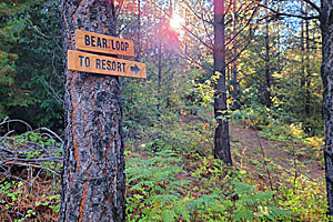
Mt. Hood National Forest covers more than a million acres in the central Oregon region surrounding Oregon’s tallest mountain, Mt. Hood. Four designated Wilderness Areas lie within its boundaries, and its diverse ecosystems include conifer rainforest, alpine meadows and tundra, lava formations and fumaroles, and high desert. More than 1,200 miles of hiking and backpacking trails can be found here, with distances and difficulty levels to suit every outdoor adventurer. From one-hour nature walks to two-week backpacking trips, Mt. Hood National Forest offers the perfect trip for you.
Visitors should contact the Mt. Hood National Forest Headquarters at (503) 668-1700 or the Visitor Information Center at 1 (888) 622-4822 for detailed trail maps to help plan a hiking or backpacking trip. Following are descriptions of a few best-known trails.
Lost Creek Trail
Lost Creek Trail is .5 miles of easy, paved, fully accessible nature walk with a picnic area at the trailhead.
Trailhead: Highway 26 to Lolo Pass Road north; turn east on Forest Route 1825; go past McNeil Campground to Rd. 1825-109; .25 mile to where the road dead-ends at the Lost Creek picnic area.
- Distance: .5 miles
- Average Time: 30 minutes
- Elevation Gain: None
- Difficulty: Easy
- Trail Type: Keyhole loop
Mirror Lake Trail
Near Government Camp, this trail is easy to access and suitable for families. Mt. Hood’s reflection in this high lake is worth the hike.
Trailhead: One mile west of Government Camp on Highway 26 at the footbridge.
- Distance: 3 miles
- Average Time: 2 hours
- Elevation Gain: 1,600 gradual feet
- Difficulty: Moderately Easy
- Trail Type: Out and back, with a .5 mile loop around Mirror Lake
Notes: Day-use Wilderness Area pass required.
Multnomah Falls Trail
This trail takes hikers to the top of famous 620-foot Multnomah Falls in the Columbia River Gorge. Two other, longer trails (Larch Mountain and Wahkeena Loop) are accessible from the top of the falls.
Trailhead: Interstate 84 to Exit 31.
- Distance: 1.2 miles
- Average Time: 1 hour
- Elevation Gain: 600 feet
- Difficulty: Moderate
- Trail Type: Out and back, with two loops accessible at the summit
Gumjuwac Trail to Lookout Mountain
Near Parkdale in the heart of Badger Creek Wilderness, Lookout Mountain’s summit affords stunning views of Mt. Hood’s eastern slopes and the Oregon high desert.
Trailhead: From Hood River, take Highway 35 south to the Robin Hood Campground. Parking is available west of the highway; cross the bridge to the trailhead.
- Distance: 7.6 miles
- Average Time: 6 hours
- Elevation Gain: 1,206 feet
- Difficulty: Difficult
- Trail Type: Out and back
Notes: Day-use Wilderness Area permit required.
Timberline Trail
This well-known trail traces the entire circumference of Mt. Hood at the tree line. Although sections have been washed out by avalanches so hikers can no longer traverse the whole circle, the trail still provides an excellent backpacking route.
Trailhead: The trailhead is adjacent to Timberline Lodge; take Highway 26 to Timberline Lodge Road.
- Distance: 40 miles
- Average Time: 5 days
- Elevation Gain: 4,000 feet
- Difficulty: Difficult
- Trail Type: Loop
Notes: Wilderness permits required; group size limited to 12; dangerous areas include swollen river crossings and snow on the trail.


